Mapping the shallow subsurface of Mars
UNDERGRADUATE RESEARCH · SUNY GENESEO · 2019
THE QUESTION
What can fracture exposures reveal about the shallow subsurface near NASA’s InSight landing region? Orbital images cannot excavate the ground, but fossae—long fractures and troughs in the Martian crust—expose a vertical record of lava plains, sediment, weathering, and regolith that can be read from orbit.
STUDY AREA
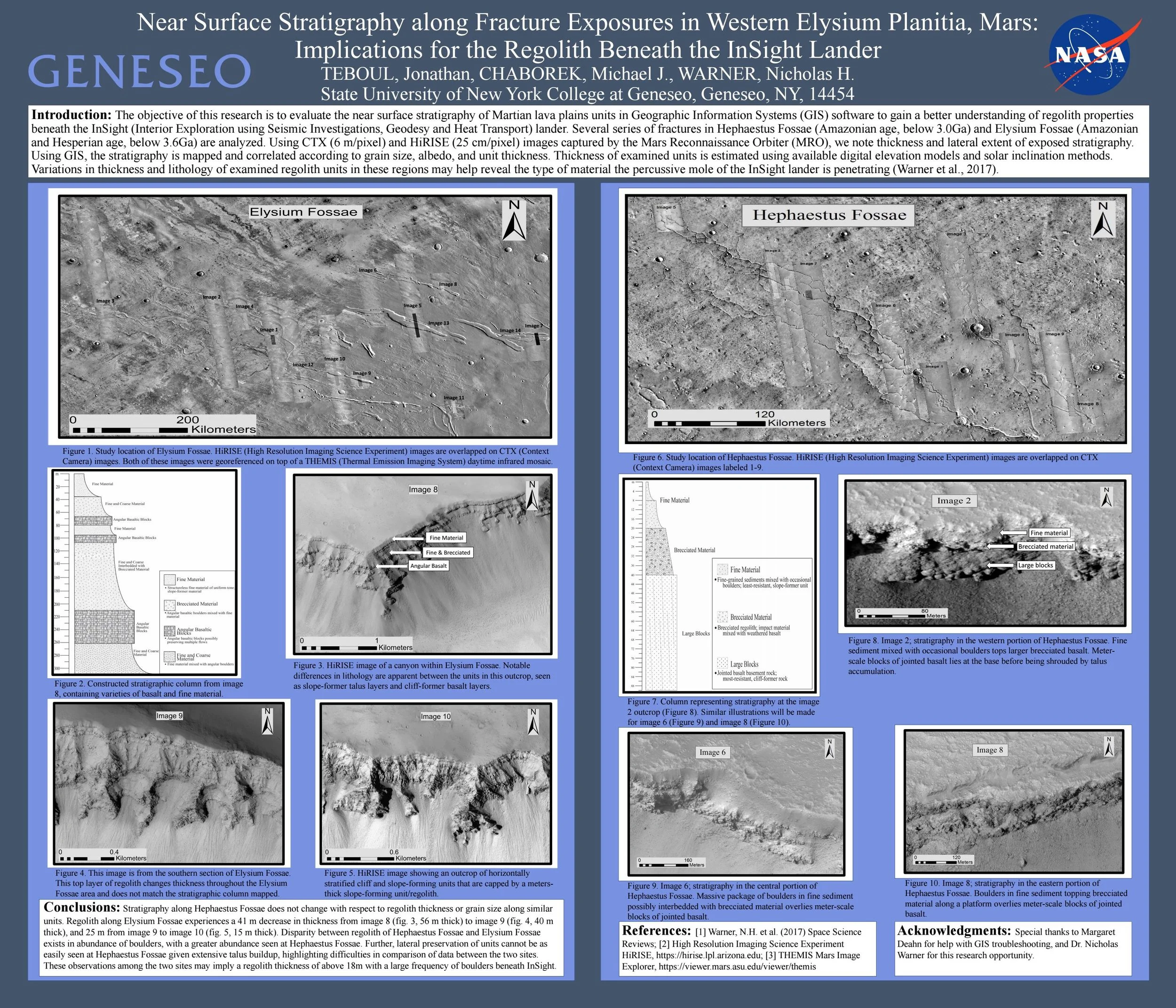
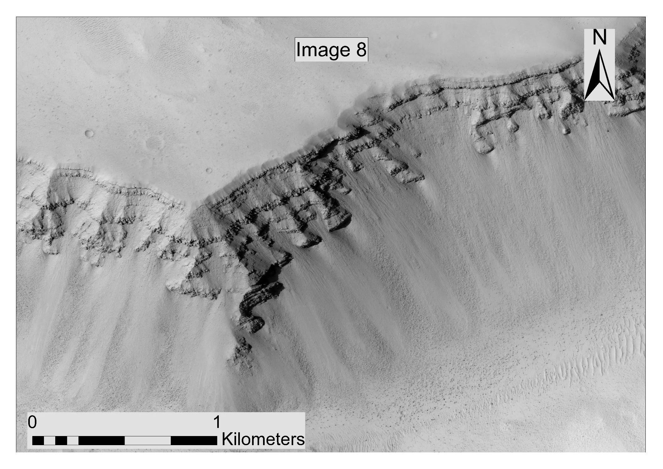
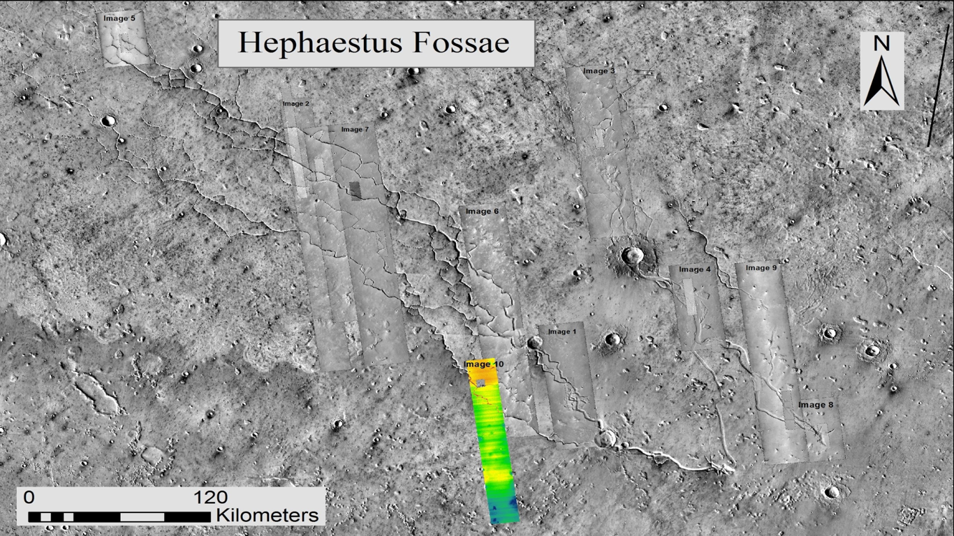
I examined exposed stratigraphy at Hephaestus Fossae and Elysium Fossae in western Elysium Planitia. These Hesperian- to Amazonian-aged surfaces provide natural cross sections through terrain broadly representative of the region explored by InSight.
ORBITAL DATA AS FIELD EVIDENCE
CTX imagery at approximately 6 meters per pixel established regional context, while HiRISE imagery at approximately 25 centimeters per pixel resolved individual blocks, finer material, and contacts between units. Digital elevation models and solar-shadow geometry helped translate those observations into estimates of exposed thickness.
READING THE STRATIGRAPHY
I mapped and correlated units by grain size, albedo, morphology, and thickness. The resulting stratigraphic columns distinguished fine material, brecciated zones, angular basalt, and large blocks—turning two-dimensional orbital scenes into a comparable record of the near-surface subsurface.
MY ROLE
Using ArcGIS, I organized and georeferenced imagery, mapped fracture exposures, measured unit thickness, compared boulder abundance, and built the cartographic and stratigraphic products used to interpret the sites. The work combined remote sensing, geomorphology, GIS, and three-dimensional reasoning.
RESEARCH TEAM
I completed this undergraduate research with Michael J. Chaborek under the direction of Dr. Nicholas H. Warner at SUNY Geneseo. We presented the study at GREAT Day in 2019.
WHAT WE FOUND
At Hephaestus Fossae, comparable units showed little change in regolith thickness or grain size along the examined exposures. The site also displayed greater boulder abundance than Elysium Fossae, although extensive talus obscured some contacts and made lateral correlation more difficult.
Across the examined Elysium Fossae locations, estimated regolith thicknesses declined from approximately 56 meters to 40 meters and then 15 meters, revealing more pronounced spatial variation.
INTERPRETATION
The observations supported the study’s interpretation that the InSight landing region may overlie a relatively thick, boulder-rich regolith—potentially exceeding about 18 meters in places. The contrast between sites also reinforced an important caution: orbital stratigraphy is shaped by exposure quality, talus cover, and the limits of remote measurement.
WHY IT MATTERS
Before a lander or rover touches Mars, orbital geology provides the framework for understanding what may lie beneath it. This project showed how GIS and high-resolution imagery can transform distant fracture walls into evidence about subsurface structure, regolith development, and landing-site context.
METHODS & TOOLS
ArcGIS · CTX and HiRISE imagery · THEMIS basemaps · Georeferencing · Digital elevation models · Solar-shadow measurements · Geomorphic interpretation · Stratigraphic correlation · Cartography
RESEARCH POSTER
Teboul, J., Chaborek, M. J., & Warner, N. H. (2019). Near surface stratigraphy along fracture exposures in western Elysium Planitia, Mars: Implications for the regolith beneath the InSight lander [Poster presentation]. Geneseo Recognizing Excellence, Achievement & Talent (GREAT) Day, State University of New York College at Geneseo, Geneseo, NY, United States.